Here is Devin Smith’s response to my email letter of December 13, 2013, which you can read here: Letter to Devin Smith
First, here is my brief response, followed by Mr. Smith’s letter.
Dear Devin Smith,
Thank you for your response to my letter of yesterday.
I see where your analysis equates a modeled historical condition with a full diversion of the Skagit River into a new channel. I would need expert consultation to understand and judge that well. One catastrophic circumstance I’ve imagined as plausible is a sudden blockage of the Skagit that sends the entire river into the channel during flood conditions exceeding the 100-year flood level, coupled with a blockage of the downstream exit to the Barnaby. That’s a low probability circumstance, but plausible nevertheless, and given the proximity of our residential community, a project featuring an intentional diversion of the existing Skagit River needs to standup to such a possibility.
I think it would be valuable for us to see and thoroughly understand a real time “what if” modeling of your design alternatives as you refine them, applying the various conditions you and our community identify as possible. Perhaps our stakeholder advisory representatives will discuss this with you and your team and agree on an appropriate approach.
Thanks again,
Dave Hallock
On Dec 14, 2015, at 11:04 AM, Devin Smith <DSmith@skagitcoop.org> wrote:
Dave,
Thanks for your feedback and I am glad you thought the meeting went well. We were also happy with the turnout, the questions, and the overall discussion.
In terms of the specific question about modeling for a potential catastrophic scenario, the analysis I referred to at the meeting is the historic condition model run that was described in the final report for our Alternatives Analysis:
https://barnabystudy.files.wordpress.com/2015/03/
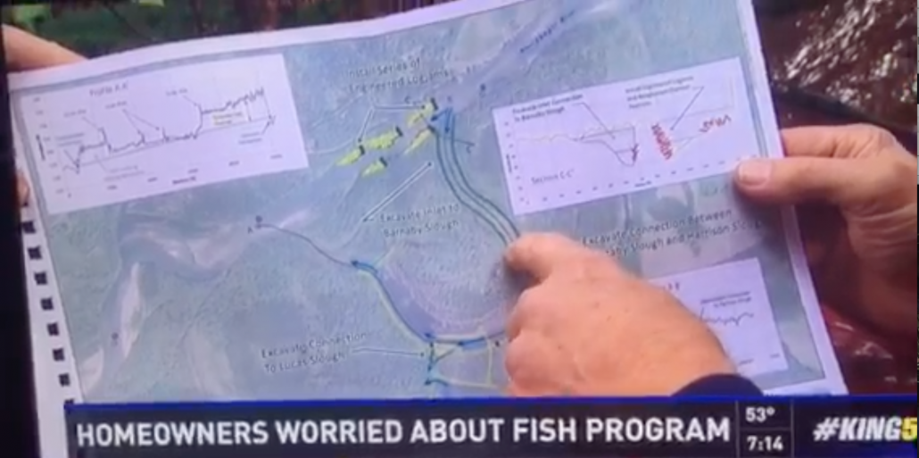
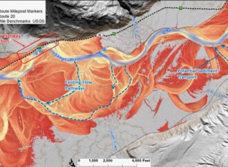
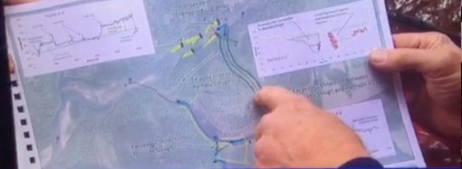
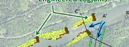
The hydraulic modeling is described section 3.3 starting on page 58, and the historic condition model run is first discussed in section 3.3.2 on page 62. This model run looked at what conditions might look like if the entire river were to occupy Barnaby Slough — it did not look at the risk of that occurring or what might cause it (either Alt 4 or a natural landslide or other occurrence), but was intended to evaluate conditions if that were to happen. The results are discussed in several places in section 3.3 and the model outputs are displayed graphically in Map Set E, on many of the results pages labeled as “Historic Condition” and then specifically on sheets 10-12, which show no change to flood heights on private properties near Martin Road during the 100-yr flood and a reduction in downstream velocities (and likely erosion) in the main channel for 2-yr and 100-yr floods. These sheets can be found here:
https://barnabystudy.files.wordpress.com/2015/03/
This is by no means a comprehensive risk analysis, and has the same limitations as we have discussed for the other modeling work, so we have much more work to do to fully evaluate potential future conditions, but I wanted to draw attention to the fact that we have already been thinking along these lines. The initial results were positive and helped inform our decision to move forward with additional work. Looking ahead, it is our intention to develop a project that will be successful under a broad range of future river conditions, including those with a low likelihood of occurring.
I hope this is informative. Please call if you have further questions.
Devin Smith
Senior Restoration Ecologist
Skagit River System Cooperative
PO Box 368 La Conner, WA 98257
360-391-1984 (direct)
360-466-7228 (main office)


Leave a Comment
Your email address will not be published. Required fields are marked with *