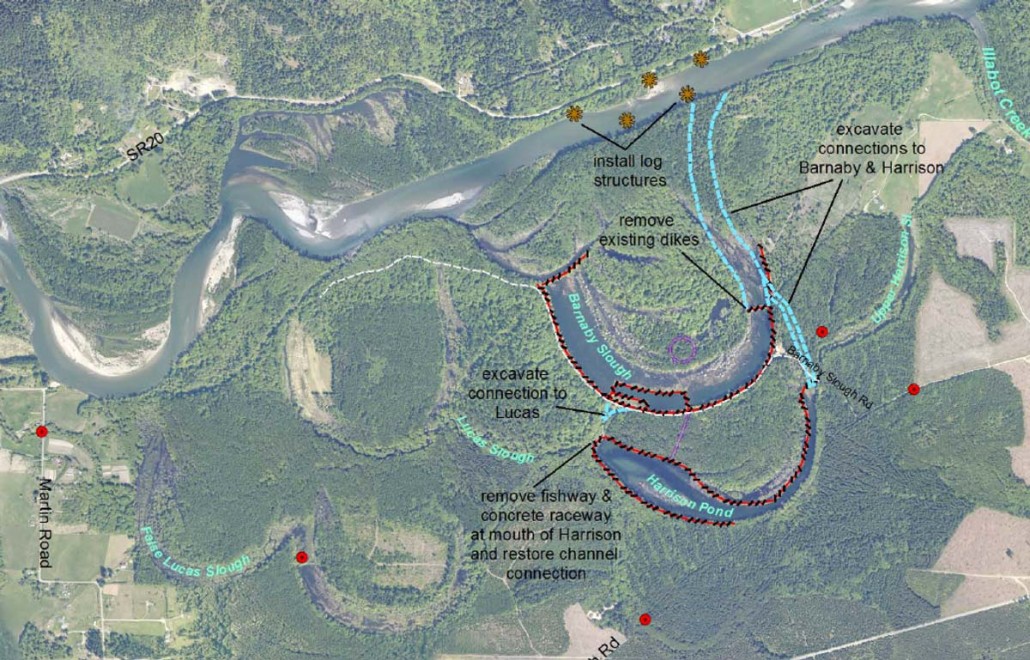
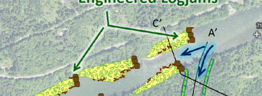
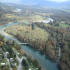
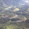
The Skagit River System Cooperative is claiming that there will be no risk of flooding if its “Alternative #4” is implemented. Alternative #4 involves cutting a wide channel to divert a significant portion of Skagit River flow into and out of the Barnaby Slough. The channel was described as being 270 feet wide and the estimated amount of river flow was 30%.
They put it like this:
“Alternatives 1-3 – No change to the existing flood and erosion risks.
Alternative 4 – Increase in flood levels within the Barnaby Slough / Harrison Pond complex and near the
State Route 20 upstream of the project, but no increase in flood heights downstream.”
— Barnaby Fact Sheet, July, 2015
There is no way that a diversion of the Skagit River southwestward across the flood plain can be confidently controlled. Just 30% of the river? What if the river gets blocked? What if there’s a slide? The idea that nature can be reliably controlled is a fiction. It’s hubris of the worst kind as it may result in great harm to our neighbors.
In fact, the act of cutting a channel to let significant river flow move diagonally through the Barnaby sets up the possibility of catastrophic flooding. I call it “exposure to risk.”
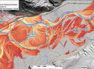
The complicated computer modeling work done to support this project is also highly suspect. Any time computer modeling is done in support of a desired outcome, the model needs to be questioned. Models can be made to yield desired results. In this case, the desired result was, “…no increase in flood heights downstream.”
At the Sedro-Woolley public meeting, Steve Hinton, SRSC Restoration Manager, acknowledged that “worst case scenario” modeling showed flooding on Martin Road. “So we stopped that modeling,” Mr. Hinton stated.
The SRSC is using certain assumptions to drive its analysis, such as the 100-year flood historical flood levels. Input assumptions like that are insufficiently conservative. With the rise in global warming, increases in regional precipitation levels and the recently well publicized likelihood of a major earthquake in our region, far more conservative assumptions must be employed.
The channel idea needs to be abandoned. A channel creates exposure to flood risk that cannot be mitigated. It’s like drilling a hole in the hull of a boat to accommodate a depth sounder. The hole creates exposure to risk that can’t be eliminated once the hole is cut.
I will hold the SRSC, The Nature Conservancy, the Washington Department of Fish and Wildlife, and Seattle City Light legally responsible for the consequences of their collusion to put our homes and lands at risk of flooding.


Leave a Comment
Your email address will not be published. Required fields are marked with *