"Too Many Unknowns," Howard Stafford Tells King 5 News
- Barnaby Project, Featured, News Items, Pinned
- November 5, 2015
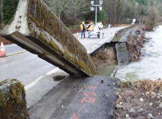
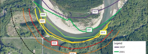
By Lisa Fenley, WSDOT, your project created the pooling of water that undermined highway 20 east of Rockport. You can’t put that much debris in a body of water and not expect water pressure to build elsewhere, like right in front of (at the upstream end of) the man-made logjam. The debris got caught up
READ MORE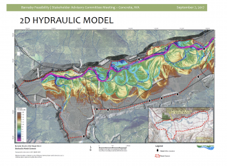
The Washington Department of Natural Resources has just published an informative “Story Map” on the use of LiDAR (Light Detection And Ranging) technology by geologists to study the earth’s surface. This technology is being used in the development of computer simulation models for the Barnaby Reach project. To view the story map, “The Bare Earth,” and
READ MORE
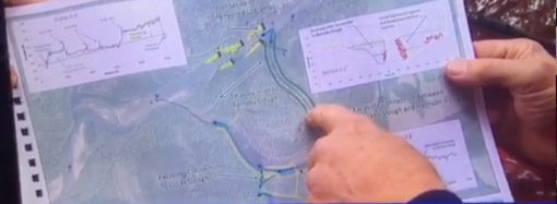
By Dave Hallock with Christie Fairchild and Howard Stafford The Barnaby Reach Project’s Stakeholder Advisory Committee met on September 7, 2017, in Concrete. This committee is composed of representatives of the significant area stakeholders in the project, including: designated representatives of residential land owners; the National Park Service, the Washington Department of Transportation, the Washington
READ MORE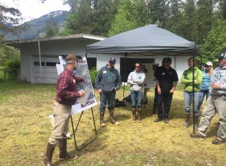
Here is a project update letter from Cynthia Carstad, Consultant to the Skagit River System Cooperative for its Barnaby Reach Habitat Project. “Greetings! This message is being sent to individuals who have requested to receive updates on the Barnaby Reach Habitat Project. On May 13, more than 26 community members and other stakeholders attended the
READ MORE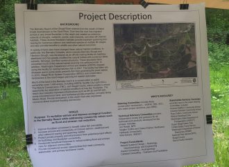
By Dave Hallock Thanks to Devin Smith of the Skagit River System Cooperative and his staff for conducting an informative walking tour of the Barnaby Reach project area this afternoon. We had a good turnout of neighbors and there was a lot of helpful information sharing and conversation. It was great that Skagit County Commissioners
READ MORE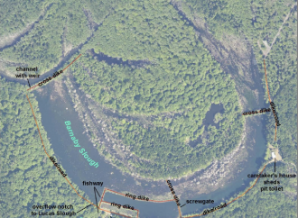
A site tour of the Barnaby Reach project site is planned for Saturday, May 13th, at 1 p.m. (Click on image to enlarge): Here is a copy of the “Barnaby Fact Sheet” which will be distributed at the tour. Barnaby Fact Sheet May2017 FINAL
READ MORE